Tuesday, May 23, 2023

May 16 King's Canyon National Park


Today we decide to drive to King’s canyon.  Because of road closures in the parks, one can’t just drive from one right into the other one like one normally would.  In Sequoia, the roads are closed due to washed out areas.  In King’s Canyon, they are closed due to excessive snow that hasn’t melted.  So, Drive out of Sequoia, around into town, up to the Northern edge of King’s Canyon and drive in there.  What would usually take about 45 minutes of beautiful scenery is 2 hours of going through the flat orange groves and some traffic. 

Once at the park we visit the stand of Sequoias that we  can access.  We can’t get to General Sherman but we can get to General Grant.  They are huge.  We hear several different languages.  German, French, Spanish, one of the Asian languages.  And, oh, English too.  I really prefer the stand of Red Woods near Janet and Alex’s place in Merrin County.  Huge trees, few people and you can go right up to them, walk inside them.  These are a bit bigger but once you get to huge, it’s just more huge and huger.


Back at the visitor’s center, we get some recommendations of hikes.  The one to Hume Lake sounds like our speed.  About 3 miles, mostly flat and a pretty lake.  We drive about 20 minutes to the trail head where we can see the lake.  It is a stream that loggers dammed and is now a beautiful lake that supports lots of wild life.  We enjoy our picnic lunch at the edge of the lake and continue around the lake.  One area of the lake is a Christian camp.  No campers now but I’m sure when they are there, it really affects the atmosphere of the area.  We were almost all the way around the lake when we came to the raging water gushing into the lake.  We had been wondering where the water came from to make such a large lake.  Then we came to the dam.  It was constructed in the mid 1800’s and used several arches to strengthen the dam without using as much material. 


We head back to Sequoia park and our campsite.  We have groceries for one more dinner and we’re going to be there 2 more nights.  We decide that tonight is the night for a restaurant meal since we’re already out of the park anyway.  We aren’t really ready for dinner so we stop at a Starbucks to relax and take advantage of their free internet.  I get most of my pictures uploaded from my phone to my computer so I can post them on this blog.  I’ve been typing the text in word and transferring it to the blog when I have internet. 

We go to a nice Japanese restaurant for dinner.  Sashimi bento box for me.

We’re starting to match our sleep cycle to something that resembles daylight and darkness.  It’s dark so time for bed.


May 15, Sequoia National Park

 Sequoia National Park 

What a joy to sleep with the sound of a roaring river and looking up through the tent vents and seeing stars!


We make friendly with our next camp neighbors.  He used to be one of the trainers for the Braves.  Now he works for a different team.  Doesn’t matter which one if it isn’t the Braves. 

Nick makes a nice bacon, hash browns and scrambled eggs breakfast.  Everything tastes better when eaten outdoors. I make some sandwiches to take with us on a hike.  At the store we got some Wickles Pickles.  They have a wicked bite to them and will add a nice touch to the ham and cheese sandwiches. 


We drive to the Visitor’s center – always a nice place to start to get their recommendations on hikes etc.  Nick found a really nice purple mug which will be a fellow traveler for the rest of the trip. 

Even though a large part of the park is closed due to road repairs after the heavy spring rains, there are still several choices for hikes.  Most of them are hiking in and out on the same trail, which means we turn back when we’re half done with our hike.  We choose the one that starts where we were stargazing last night.  We don’t get far and Nick asks if I have my eppi pins.  Oh Crap!  No!  They are on the bedside bin in the tent.  Back we go.  A VERY short hike.  It’s already quite warm.  We decide after all of our hard driving days that relaxing at the site would be nice and we’ll take a late afternoon hike from our camp spot.   So, here I am, sitting in the shade, babbling brook…..a Robin hopping by????

Our neighbors come over and say that they have to move to a different campsite because they couldn’t get reservations for both nights for the same site.  But, the people at the new site haven’t left yet.  They ask us to let the people know that they plan to move if the new neighbors arrive before they get back.  Sure, no problem. 

We make an excursion out of going into town to Walmart to pick up some flavored water for Nick.  The highlight is a stop at a candy and ice cream shop.  Se sample several varieties of ice-cream.  I settle on a chocolate toffee. Nick got coffee.  


The heat is really getting to Nick and he has no energy for any kind of a walk.  I’m antsy so decide to do a walk that starts at the campground.  It could take one all the way to the Hospital Picnic ground (I’m still wondering why it has that name).  That is about 2/12 miles each way.  A bit further than I really want to do.  It’s about :30 so starting to cool down.  The walk basically follows the river and the road but far enough from the road to not hear it.  There are several varieties of wild flowers that are blooming.  Sometimes, the path is very narrow with tall grasses tring to choke the path off.  I come to a point with a sign saying “River”.  It is fairly steep down.  I come close to the river and there is a strange contraption going across the river.  A strong cable with a metal bucket that looks like it’s designed to carry one person in it.  Across the river is a receiving point.  I don’t take a picture of it as I’m looking for nature pictures.  I turn back.  After the steep walk back up from the river, the path is easy and slightly down hill.  I look up and there is a deer in the middle of the path.  I freeze.  It is easier for the deer to leave the trail than it is for me.  So, I take a few slow steps closer.  The deer graciously steps aside and warily lets me pass. 


When I got back to camp, Nick asked if I had gotten to the swing bridge.  Oh, YES!  That’s what that metal contraption was that I worked hard to keep out of my pictures.

Nick makes a couple of steaks, and hash browns and I cut up a small watermelon to go with it.  Our new neighbors show up and no sign of our old neighbors.  We relay the situation and tell them to just go ahead and set up camp.  It’s getting later and still no sign of the old neighbors.  We all are starting to worry about them.  They left about 1:00.  Vic was wearing swimming trunks with a towel draped over his shoulders.  Hmmm.  Now it’s about 10 PM and still no sign of them.  We talk with the new neighbors and agree that we will make a missing person report at the visitor’s center in the morning if they still aren’t back.   It’s about 10:30 and we head for bed wondering if we will be able to sleep worrying about Natalie and Vic.  Ah! The pull in! Yeah!  Now we can sleep in peace. 

Tuesday, May 16, 2023

Joshua Tree National Park May 14

We woke up early this morning which is good as we want to visit Joshua Tree National Park before heading up to Sequoia National Park where we will actually start the camping part of our adventures.

The visitor’s center is actually in the town of 29 Palms and doesn’t open until 9:00.  The park opens earlier.  There is a ranger talk at 9:00.  That will be a nice way to get an intensive quick exposure to the park. 

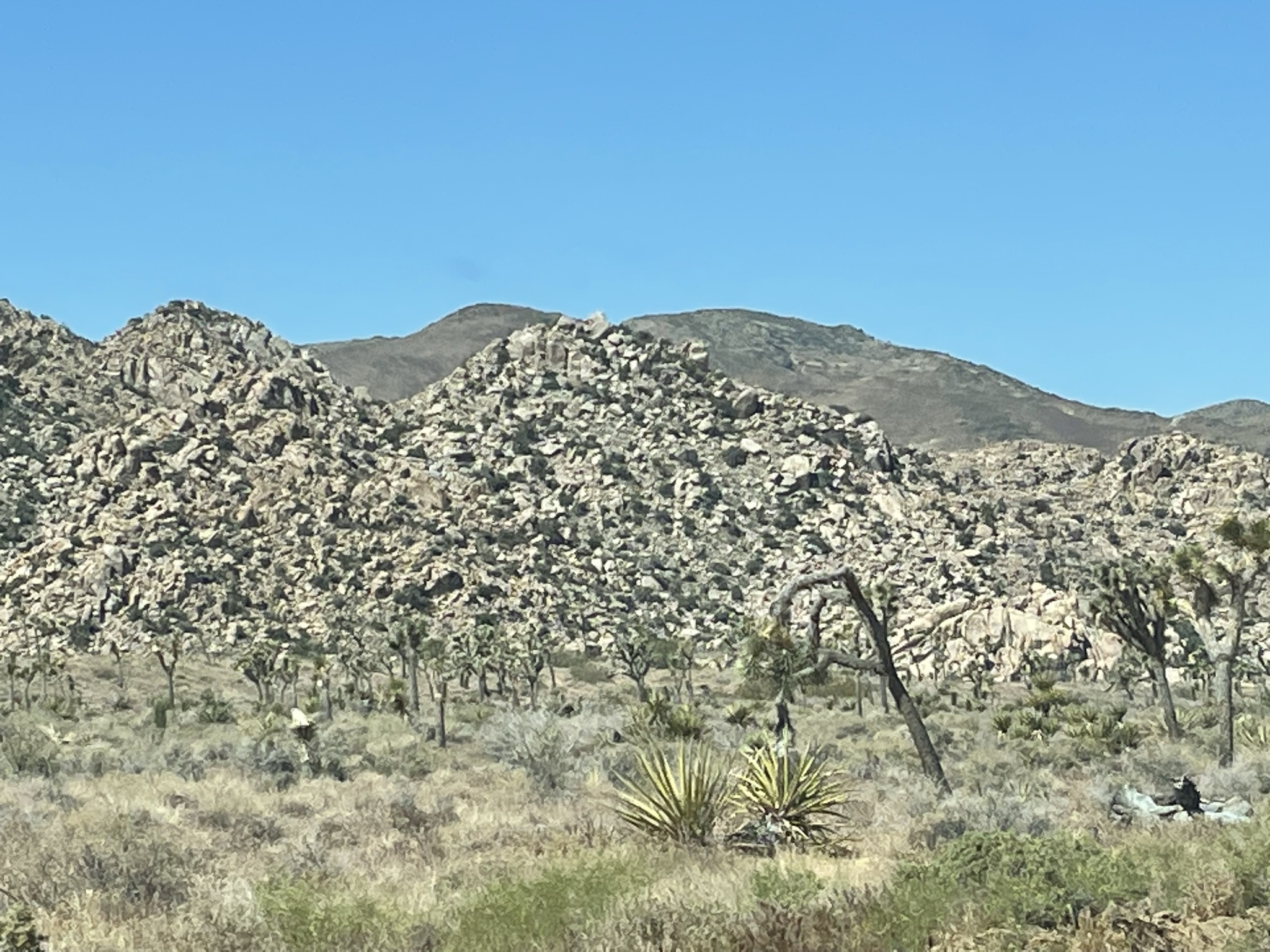
We enter the park (Sure do love those senior park passes).  First impression  - Looks like a cosmic-sized land mover has cleared the land and pushed it all into big rock piles.  A little further in and those piles start looking more like huge rock blocks stacked randomly.  Oh my!  A snow capped mountain suddenly appears as we go around a curve. 


We drive deeper into the park for about 30 minutes and arrive at Keys View.  There is a big parking lot and we are the only car there.  Nice!  Oh, there are 2 snow-capped mountains in view.  The view is impressive.  A sign indicates that we can see mountains 30 miles away.  The valley below is dry.  It used to be green but the river was diverted upstream for irrigating fields upstream.  We humans are worse than beavers.  We later find out from the ranger that the San Andres fault goes right down the valley.  The fault is what caused all the rubble we saw as we entered the park with huge igneous rock hidden under the rubble.  By the time we left the Keys view parking lot, there were several more cars. 


We head to Cap Rock where the ranger will give his talk.  Small talk while we’re waiting for others to gather for the lecture.  Turns out the ranger grew up in Smyrna. 


Interesting tidbits from the Ranger Talk:

The Joshua Tree was named by the Mormons who thought a valley of the trees looked like Joshua’s army.  Somehow the name stuck.

The tree is of the Yucca family.  When a bloom forms at the end of a branch, it stops the growth there and the new growth starts next to it.  This is what causes the interesting branching of the trees.

 The flowers are pollinated by a special moth.  One of those mutually beneficial relationships. 

The trees grow about 1 1/2 Inches a year.  The age of the tree is determined by it’s height and the number of branching it has.  The older ones are about 300 years old. 

The park is where the Colorado and Senora desserts merge.  The desserts are determined by what plants grow there.  The Joshua trees require the cooler, slightly damper climates of higher altitudes. 


Time to hit the road for a 6-7 hour drive to Sequoia.  We will be skirting around LA and then heading North.  A couple of traffic back-ups…..  We are in the vicinity of LA after all. 

Oh dear, we broke our no chain restaurant rule.  There is sooooo little along the highway we’re taking.  We tried the Little Chicken that was connected with the gas station.  YUCK! A few dried out, over fried pieces of chicken and they aren’t making any more.  I guess it’s going to be the Wendy’s that’s connected to the other gas station.  Those are the only available choices. 

As we drive, I’m impressed with how flat the valleys are and how abrupt the mountains are.  Then it’s so obvious when fields are being irrigated. 

We stop to get groceries before going into Sequoia National Park.  We have a list.  We had planned to get a rotisserie chicken for dinner tonight since we would be setting up camp, an easy dinner not requiring cooking would be nice. Ugh!  They only have one left and it looks pretty pitiful.  Maybe there will be a place to stop before we get to the park.  There is a little gas station market.  Even worse choices but they do have a 2 1/2 gallon jug of water with a spigot.  We pick that up.  What????  $11???  I don’t think so.  On to the park.

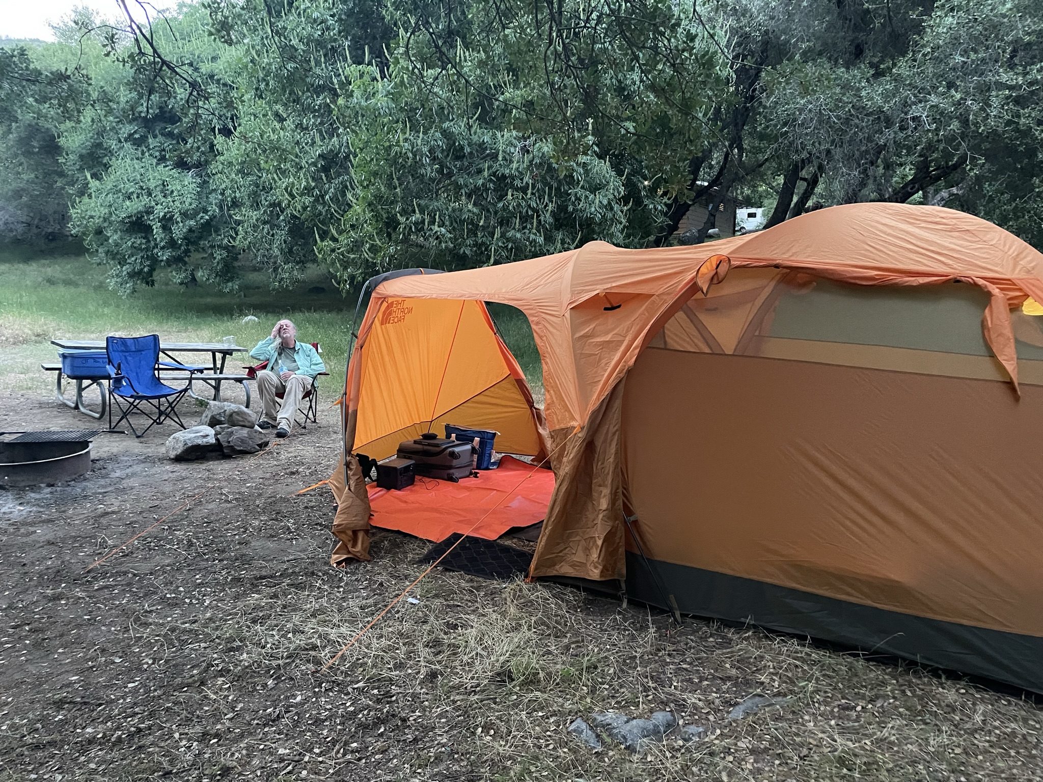
The road is very curvy with huge drop-offs and beautiful views.  We find our reserved camp spot and set up the tent.  Glad for the practice run at home, it went up smoothly and we were all set in about 30 minutes.  A beer and mixed nuts sounds like a perfect dinner. 

We hear water rushing nearby our campsite.  We follow the sound and right across the little road and down a steep embankment of rocks is a fast flowing, beautiful mountain stream.  Life is good!


The first stars (planets) are poking out.  We wait until it gets nice and dark and drive about 3 miles to where the road is closed.  Wow! It’s dark! And soooo many stars! We aren’t high enough to get a good 360 degree view of the sky but it doesn’t matter.  We sit on the ground and just look up and enjoy. 

Back to camp.  Good night.


Saturday, May 13, 2023

Saguaro National Park May 13


We really are covering lots of territory!

This morning we have the Best Western included breakfast.  A little change from the norm is that we could eat outside by the pool if we so chose.  Pack up and on the road.

There is an East and a West Saguaro National Park with Tucson between them.  The East portion is a bit higher elevation and gets a bit more rainfall.  The higher elevations have a mixture of deciduous and conifers.  We chose to go to the Western park (partially because that is the way we will be traveling when we head on to our next national Park – Joshua tree.  But Waze got a bit confused and set us off towards the Visitor’s Center in the East portion.  Once we realized our mistake and turned around, we had just added an hour to our days drive.  Oh shoot, we don’t gain an hour today either.  Kinda liked those 25 hour days. 


We’re just in time for a ranger lecture at the Visitor’s Center on the life cycle of the saguaro.  They are extremely slow growing.  It takes 10 years for it to get to a foot tall.  They’re about our age when they are tall enough to start flowering and branching out.  Live to be about 150-175.  The ones in the Eastern portion live to be about 200.  The fruit that is produced in the Eastern saguros have about 1000 more seeds in them than the Western saguaro.  I guess that’s what more rain gets ya.  The accordion type pleats make it so the saguaro can expand and store water. 


We get recommendations on where to go with our limited time.  A picnic area with a shelter that frames pictures nicely.  Generally pretty deserted so can have some peace and quiet.  Then a different picnic area where we can walk a short distance and see petroglyphs.  If we had more time, we would have done the 2 ½ mile loop to see more petroglyphs.  Gotta save something for next time…..

Hmm, people eating lunch in the shelter with the good picture opportunities.  I go up and snap a few pictures anyway.   It is really fresh and pleasant in the shelter.  Amazing how much difference shade and a breeze make!


Drive on to the next stop.  Down and back up again to the top of a small hill.  Sure enough, there they are.  There is evidence of human occupation back to 10,000-8,000 BCE.  But the carvings were done by the Hohoakum people (meaning “ the people who have gone”) around 200 CE. 


It would be nice to stay longer but we have a long drive ahead to get to our next National Park – Joshua Tree in California. 

The drive is uneventful.  Amazing how flat the areas are that we’re driving through.  Yet there seems to always be presence of rugged mountains.  Sometimes in the distance and sometimes closer.   I think we’re driving through an ancient ocean bed.  We stop at a rest stop in the middle of nothing.  There is a sign warning to not walk your pets in that area as there are poisonous insects and snakes.   YIKES! I’m getting back in the car. 


We stop for lunch in Phoenix.  It’s tempting to break our “no chain on vacation” rule as all we see near the interstate exit are chains and we have so many more miles to go.  But, we look on Yelp and find a Vietnamese restaurant that is highly rated and quite close.  Parking lot is full at 3:00 on a Saturday!  The pho was good and a little lighter that we’ve been eating so that was nice. 

Sunset tonight will be on the road…..


Got into our motel about 9PM.